Editor's Note: This piece was written by Mike Danielak, director of client strategy and business development at Skyward. The opinions represented in this piece are independent of Construction Dive's views.
In the U.S., commercial drone use has accelerated across many industries. In the last two years, one million new pilots have registered with the Federal Aviation Administration, and by 2020, experts expect seven million drones to be in use.
The 2017 Drone Market Sector Report found that construction (design, building inspection or monitoring) is in the top three uses for commercial drone-based services, behind aerial photography, surveying and mapping, and geographic information systems (GIS). The number of construction and engineering companies using drones is expected to continue to grow, as use cases emerge that offer further business value and competitive advantage for companies with drone programs.
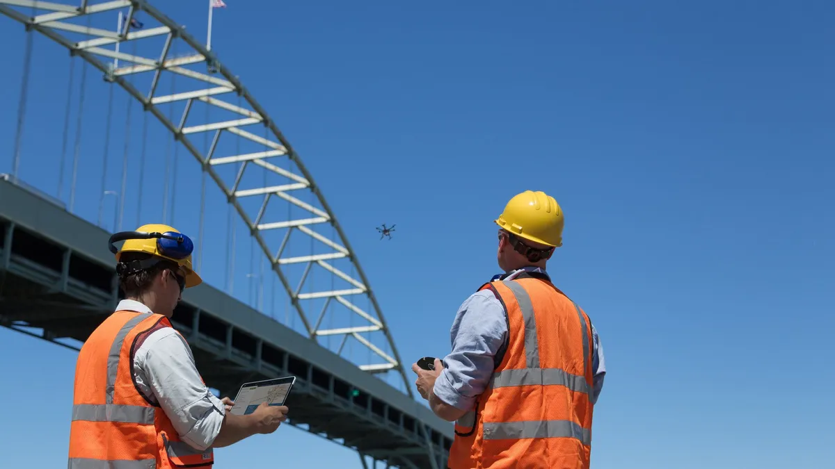
In our work with our clients, we’ve observed that construction and engineering firms are way ahead of similarly sized companies in other industries in their use of drones. Some large construction firms already employ dozens of pilots to maximize drone data at every step of the process, from marketing their services to design and project construction to ongoing inspections. Construction firms of all sizes are including drone technology or replacing old process with drone technology entirely.
One barrier that was recently overcome that previously slowed drone usage was the introduction of the FAA’s Low Altitude Authorization and Notification Capability system (LAANC — pronounced Lance). Before LAANC, to follow FAA regulations, commercial drone operators were required to manually obtain authorization to fly in controlled airspace. This was a large pain point as most major metropolitan areas include significant controlled airspace.
For construction companies like Hensel Phelps, obtaining a Part 107 airspace authorization meant a possible delay of several months to gain approval to fly a drone in the area the company needed to survey, design, build or inspect. But with the introduction of LAANC last fall, commercial operators can now use drones to access pre-approved flight zones and maximum altitudes for operating drones near 49 airports — giving commercial drone operations instant access to areas that previously required lengthy approvals. LAANC is expected to be available at all 900 facilities across the U.S. by September.
We expect LAANC to further catapult the use of drones within construction and engineering firms to help keep critical, and potentially budget-sensitive, construction schedules on track. With LAANC, more companies can use drones to reshape the construction industry with faster, cheaper, safer and simpler execution — as well as create entirely new revenue streams.
Aiding designers, engineers and contractors
Drones are becoming an essential component of virtual design and construction (VDC), giving architects and engineers new and efficient ways to visualize and analyze structural requirements from the ground up.
Using drones to capture survey images of the site is only the beginning of the value that they can offer a construction firm. The planning, architecture design and engineering that go into shaping what eventually becomes a building all require good data.
The raw data captured by the drones helps designers create 3D models and maps that can be packaged and sold under various pricing structures. This becomes yet another tool in the surveyor’s arsenal, adding to traditional surveying with modern technology.
Designers can create building information models (BIM) and 3D renderings of a site, layer by layer, using drone-obtained point clouds. Not only is this an effective way to show clients how a project will progress, it can also help to identify potential site or design problems.
Reducing safety risks
These survey and design tasks have traditionally required a plane, crane or helicopter, as well as a staff of data scientists. Drones provide the opportunity to offer these services at a more competitive rate and with the added bonus of gathering the data safely — a top priority for construction and engineering firms.
Jobsite safety is especially important for PBS Engineering and Environmental Inc., which provides professional engineering, environmental, industrial hygiene, planning and surveying services throughout the Pacific Northwest. PBS’s projects often involve accessing hazardous areas so the firm established a drone program to gather better data and eliminate risk to their workers whenever possible.
Earlier this year, PBS was contracted to provide a topographical survey of a road along the Snake River in Asotin County, Washington — a winding road that includes rock overhangs that would potentially need to be excavated. Instead of using a traditional ground-based LiDAR surveying system, the company opted to conduct a drone-based aerial survey to keep workers out of harm’s way from falls, rock slides or other dangers while still gathering the data they needed.
“The project was incredibly efficient. The on-the-scene work took only a few hours and required just three people: a pilot and two field surveyors,” said Derrick Westoby, UAS program manager at PBS Engineering. “And the best part: No one had to walk along or beneath the cliffs, which was incredibly fortunate because a minor rock slide landed on the road while we were on site. By using drones, we kept our engineers and surveyors out of harm’s way in a potentially dangerous area.”
Growing jobsite applications
Augmenting surveying, mapping, inspection and safety measures aren’t the only ways drones are reshaping how construction firms approach projects. Here are a few other use cases for drones on the construction site and for ongoing inspections:
Time lapse: Use drones to take weekly images of the structure and stitch them together into a time-lapse video. This can help in coordinating logistics among the many parties involved, while also providing progress updates to remote stakeholders. Many commercial clients are willing to pay for an easier way to visualize the progress on a new building.
Forward looking infrared (FLIR): Drones equipped with FLIR sensors can be used to detect heat in faulty electrical joints, as well as energy loss or consumption or insulation defects as part of installing and inspecting HVAC.
Thermal imaging: While construction companies have been using thermal imaging for several years, it has only recently become possible to attach a thermal sensor to a drone. The ability to take an aerial heat image, without chartering a helicopter or plane, lowers costs and may provide more scheduling flexibility. Drones with thermal sensors can accomplish a lot on a construction site — detecting thermal hotspots, delamination, spalling and moisture intrusion are all possibilities.
Boosting business development and marketing efforts
One of the primary reasons aerial photography is the number one use of commercial drones is because of the value to executive and marketing teams.
Insights from drones can help executives improve safety, project efficiency and data accuracy. On the marketing side, aerial photography and video for marketing residential and commercial real estate is one of the best-known applications for drones. Rather than hiring a crane or helicopter, many firms are choosing to spend far less money to hire a drone with a high-quality camera and a capable pilot to capture photos showing the potential view of a given office, even before the office tower has been built.
With a drone, companies can achieve unusual angles, capture the aerial perspective, and get results that would otherwise be impractical or impossible. This creates a competitive advantage when it comes to promoting a firm’s projects and services.
Drones only provide value when they’re up in the air, so once a company has made the initial investment, it’s worth it to explore as many drone applications as possible to maximize the investment — and inspire teams to innovate processes and services along the way.


