Technologies like BIM, drones, virtual reality and real-time workflow software have made an entrance that will forever alter the scope of the construction industry. Every few weeks, Construction Dive provides a roundup of the latest technology product announcements that promise to boost productivity by saving contractors time, money and labor. To view the entire series, click here.
Software update expands crane lift program capabilities
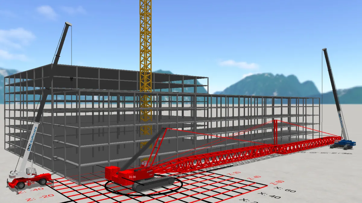
A1A Software LLC’s software expansion enhances the 3D Lift Plan so that users can take advantage of the crane lift planning program for functions such as a sales, bids and proposals, crane selection and setup, lift planning and documentation. The software uses WebGL technology so that the cloud-based program can display 3D content in Chrome, Firefox and Microsoft Edge browsers.
New features include:
-
Expanded options for crane pads or mats based on ground conditions.
-
Ground bearing calculation capabilities specific to what mats are being used.
-
Features specific to planning unique lifting scenarios, such as overriding the boom angle when using a load chart with fixed boom angles.
-
New rigging configuration as a standard option in the program’s Advanced Rigging Design portion.
MIT students conceptualize autonomous drone tech that doesn’t need GPS
NASA’s Langley Research Center tasked MIT students with finding a solution to completing challenging tasks in environments without GPS, according to MIT. In response, they developed a fleet of drones that can autonomously fly through a forest without hitting trees, communicate with one another and create a 3D map of their environment by using onboard laser-range finders for positioning and planning routes.
While piloting themselves, the quadcopter drones are positioned in space while scanning the environment at the same time by employing simultaneous localization and mapping technology. Algorithms guide the drones to efficiently map and avoid remapping any ground, then captured data is sent through a WiFi network to a base station where all of the drones maps are stitched together.
John M. Russo, a surveyor and president of the U.S. Institute of Building Documentation, said that the technology for construction could automate messy plenum space surveys and get 3D laser scans of daily construction progress in a more affordable way than using a piloted drone, according to Engineering News Record.
Cloud-based tool manages laser scan-generated point clouds
Tech company Cintoo is tackling the management of “gigantic point clouds generated from terrestrial laser scans” with its release of the Cintoo Cloud application that focuses on BIM workflows in the architecture, engineering and construction industry. Compatible with products in Autodesk's portfolio, the core technology can move billions of data points from thousands of scans to the cloud while allowing users to stream that mesh from any desktop or laptop with internet access.
In addition to the core technology, the application also has visualization features so that data can be viewed in RGB, x-ray, height or 3D surface modes. “Work zones” organize and group scans into selected areas for organization, viewing and quick access.
Platform can handle production-scale 3D printing
To tackle commonly cited obstacles of costly technology and materials, lack of scale and unreliability of 3D-printed parts, Essentium Inc. released the Essentium High Speed Extrusion Platform, a 3D printing system designed to quickly produce strong materials.
FlashFuse technology, which uses a plasma heat source to conduct electricity through a network of carbon nanotubes integrated with the company’s Ultrafuse materials, results in printed materials with similar properties of an injection-molded part. By using a non-slip, high torque extruder system and linear motors, the platform also claims to print parts 10 times faster than traditional extrusion 3D printing processes.


