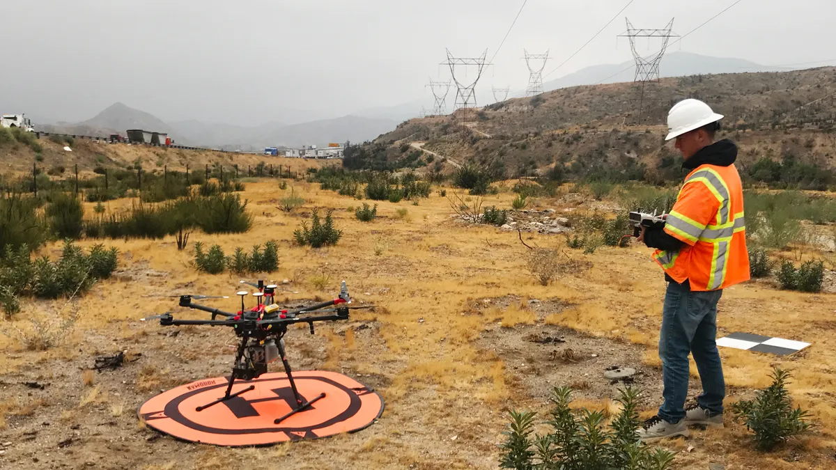
For contractors and developers that are on a tight schedule and need to map large swaths of land or expansive projects, sometimes the only thing better than the convenience and insight that unmanned aerial system (UAS), or drone, imaging provides is getting the shots back in a few hours versus days. Engineering and environmental consulting firm Dudek, which provides drone imagery services to contractors, has found an effective solution for turning around image projects for construction clients fast.
Dudek provides mapping, inspection and construction project monitoring services across the U.S., including Hawaii, where its drone operations are based. The company began using drones several years ago through outsourced services, but brought the function in-house almost two years ago. Brian Nordmann, Dudek's chief information officer, told Construction Dive that the firm now has eight full-time pilots as well as a “supporting cast” that processes data.
Dudek counts both public agencies and private developers among its drone imaging clientele, and the company's construction-related work includes pre-permitting mapping and monitoring of large infrastructure, utility and power plant projects.
For example, the firm captures drone images for the California bullet train project that has been whittled down to a $15 billion to $16 billion segment through the state’s Central Valley.
With a growing roster of drone imagery clients and most of its data processing work done at its Hawaii office, the system Dudek was using was becoming inefficient. In the case of a large development, Nordmann said, a drone flight could encompass many acres of land. After the flight, a team would upload images and data collected to a workstation and then run a series of applications to process the information into the finished product for the customer.
“The big part of that,” he said, “ is essentially stitching together all these photos that it takes into a huge map.”
However, the process for very large projects could take up to five days, Nordmann said, and there were occasions when the power would go out after day three or four or the computer simply crashed, which meant starting over.
That setup was neither sustainable nor scalable, and Dudek was looking at having to make a substantial investment in hardware to process large jobs faster, with reliability and consistency. Nordmann said Workspot Workstation Cloud on Microsoft Azure turned out to be a cost-effective alternative. Workspot, along with desktops loaded with Windows 10 and GPU (graphics processing unit) workstations, uses the cloud to ramp up — and speed up — the firm's computing capabilities.
“The software allows us to cluster multiple processing units together to act as if it was one big computer,” Nordmann said. “So, for example, we cluster eight of these together and throw a job at it, and that's how it's able to get it done so quickly."
Jobs that used to take five days of continuous processing, he said, now take about six hours. And as drones have become more of a commodity, the fast, quality product that Workspot facilitates has become a differentiator for Dudek. It also saved the company about $80,000 — the amount it would have spent to buy, build and maintain the workstations necessary to match what Workspot delivers.
Of course, there are still jobs, like building inspections, that only need a few images and don’t require a high-power, graphics-intensive program. But Nordmann said Dudek still runs the vast majority of projects through Workspot because the data automatically syncs up to the Azure environment.
“Anyone can fly a drone,” he said. “It’s what you do after that sets (you) apart."


