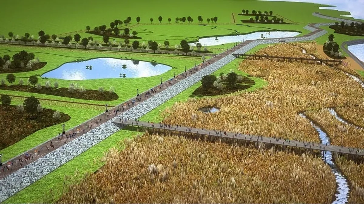
Seven years after Superstorm Sandy devastated New York City and coastal New Jersey, government officials are gearing up to build a long-awaited seawall system that will help protect the south shore of Staten Island, the borough that sits in New York Harbor, south of Manhattan.
Sandy made this area of Staten Island particularly vulnerable to future storms, according to the U.S. Army Corps of Engineers. In February, lawmakers announced that the state of New York and the Corps had agreed on the terms of a Project Partnership Agreement (PPA), making it possible to move forward on the $615 million seawall construction. Finalization of the agreement means that New York City has been able to transfer $215 million to the Corps so work on the project can begin.
The PPA identified the funding and work execution responsibilities for the Corps and its non-federal-government partners. The agreement also cleared the way for a federal contribution of $400 million. New York City has set aside $65 million for the seawall project and New York state will contribute $151 million.
Seawall system specs
The Staten Island seawall system construction is scheduled to begin in 2020. Also referred to as a multi-use elevated promenade, the system will stretch approximately 5.3 miles from Oakwood Beach to Fort Wadsworth. It will include:
- 4.5 miles of buried seawall
- 0.6 mile levee gate
- 0.35 miles of floodwalls
- 180 acres of ponding areas
- 46 acres of tidal wetlands
- 300 acres of natural water storage
Intended to make Staten Island's low-lying, flood-prone areas more resilient to future storms, the system also was designed to protect vital infrastructure, including a wastewater plant, Staten Island University Hospital, police and fire stations, schools and community senior centers. During Sandy, 80% of structures in the future seawall's protected area sustained damage as floodwaters of more than 10 feet deep — 4 feet higher than the prior record — contributed to 43 fatalities in New York City, 24 on Staten Island alone.
During the hurricane, water depth peaked at 12.5 feet above sea level; the Corps plan will put maximum protection of the buried seawall at 19.4 feet above sea level. With the addition of the planned boardwalk on top of the levee, that rises to 21.4 feet.


